Mafeteng
Mafeteng is a city in Lesotho, and the Camptown (capital city) of the district of Mafeteng. It is located about 76 kilometres south of the country's capital, Maseru and has a population of approximately 61,000. The South African border town to Mafeteng is Wepener.
The town is said to be named after an early visitor, Emile Roland, who was nicknamed "Lefeta," literally meaning "traveller" or "passer-by." Mafeteng translates to English as "The place of the passers-by."
During the Gun War of 1880/81 a great deal of fighting took place near Mafeteng. The cemetery, located near Mafeteng's Bantu Stadium, contains an obelisk in memory of members of the Cape forces who fell in action in the area.
One of the sights in Mafeteng remains the Diphiring Mill, a fully working roller mill established outside the town by Mr. William S. Scott in 1912 and currently operated by the Osborne Family, millers by trade. The whole mill is run off a single engine by an intricate pulley system. Basotho people use the mill to process maize, wheat, millet and other grains.
Mafeteng has several industrial developments including a Gap/Old Navy clothing factory and the Lesotho Pharmaceutical Company (LPC), which also exports to several countries in the region. Mafeteng has two hotels, the Golden Hotel located on the road to Maseru and the Mafeteng Hotel located on Hospital Road. The hotels are the center of the town's limited nightlife: each has a public and a private bar.
Mafeteng has little tourism although travelers occasionally stop at the Buy N Take en route to the Van Rooyen's Gate border crossing at Wepener or Malealea Lodge, a tourist destination in Mafeteng District.
The Famo musician Mosotho Chakela was born in Mafeteng in 1963.
Mafeteng is home to Bantu Stadium. In the past it has hosted district track and field, volleyball, netball and soccer tournaments. The winners proceed to national tournaments in Maseru to represent the district. In 2004, the St. Thomas High School soccer squad advanced out of the tournament in Bantu Stadium and captured the national title. Following the 2004 events, however, Bantu Stadium had to be closed due to renovation of the fences which surround the field and viewing areas.
* The Rough Guide to South Africa
Map - Mafeteng
Map
Country - Lesotho
 |
 |
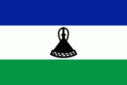
| Flag of Lesotho | |
It was previously the British Crown colony of Basutoland, which was given independence by the United Kingdom on 4 October 1966. It is a fully sovereign state and is a member of the United Nations, the Commonwealth of Nations, the African Union, and the Southern African Development Community. The name Lesotho roughly translates to "land of the Sotho".
Currency / Language
| ISO | Currency | Symbol | Significant figures |
|---|---|---|---|
| LSL | Lesotho loti | L | 2 |
| ZAR | South African rand | Rs | 2 |
| ISO | Language |
|---|---|
| EN | English language |
| ST | Sotho language |
| XH | Xhosa language |
| ZU | Zulu language |


